Does my project qualify for priority points?
To help with your understanding of the Priorities and who will qualify, we offer the following information:
Creating More and Better Markets
Assisting rural communities to recover economically through more and better market opportunities through improved infrastructure.
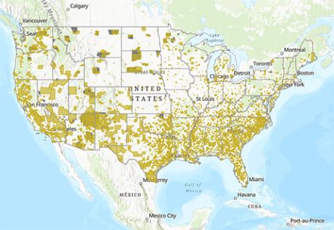
Applicants receive priority points if the project is located in or serving a rural community whose economic well-being ranks in the most distressed tier of the Distressed Communities Index. The Distressed Communities Index provides a score between 1-100 for every community at the zip code level. The most distressed tier of the index are those communities with a score over 80. Please use the Distressed Communities Index Look-Up Map to determine if your project qualifies for priority points.
Note: US Territories are considered distressed and qualify for priority points.
Map Helpful hints:
- The optimal web browsers for this map is Microsoft Edge or Chrome. This map will not function properly in Internet Explorer.
- To see county and county names zoom into the location or put the name of the location into the search bar and they will then be visible.
Advancing Racial Justice, Place-Based Equity, and Opportunity
Ensuring all rural residents have equitable access to RD programs and benefits from RD funded projects.
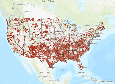
Priority Points: Applicant receives priority points if the project is located in or serving a community with score 0.75 or above on the CDC Social Vulnerability Index. Please use Community Look-Up Map to look up map or list to determine if your project qualifies for priority points.
Applications from and benefiting a Rural Partner's Network's (RPN) community network will receive priority points (rural.gov) in applicable funding notices. Currently RPN Networks exist in Alaska, Arizona, Georgia, Kentucky, Mississippi, Nevada, New Mexico, North Carolina, Puerto Rico, West Virginia and Wisconsin. Please use the Community Look-Up map to determine if your project qualifies for priority points.
Applications from Federally Recognized Tribes, including Tribal instrumentalities and entities that are wholly owned by Tribes will receive priority points. Federally Recognized Tribes are classified as any Indian or Alaska Native tribe, band, nation, pueblo, village or community as defined by the Federally Recognized Indian Tribe List Act (List Act) of 1994 (Public Law 103-454). Please refer to the Bureau of Indian Affairs for a listing of Federally Recognized Tribes.
Additionally, projects where at least 50% of the project beneficiaries are members of Federally Recognized Tribes, will receive priority points if applications from non-Tribal applicants include a Tribal Resolution of Consent from the Tribe or Tribes that the applicant is proposing to serve.
Note: US Territories are considered socially vulnerable and qualify for priority points.
Map Helpful hints:
- The optimal web browsers for this map is Microsoft Edge or Chrome. This map will not function properly in Internet Explorer.
- To see county and county names zoom into the location or put the name of the location into the search bar and they will then be visible.
Please use the Social Vulnerability Index Look-up Map to determine if your project qualifies for priority points.

Addressing Climate
NOTE: The below priority points do not apply to the Rural Energy for America Program (REAP) as covered under the Inflation Reduction Act (IRA). To determine priority points for REAP IRA, use the look-up map of Distressed and Disadvantaged Communities.
Reducing climate pollution and increasing resilience to the impacts of climate change through economic support to rural communities.
Priority Points: Applicant can receive priority points through one of the three options listed below:
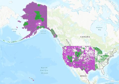
Option 1: Applicants will receive points if the project is located in or serves a Disadvantaged Community as defined by the Climate and Economic Justice Screening Tool (CEJST). Census tracts are considered disadvantaged if they meet the thresholds for at least one of the CEJST’s eight (8) categories of burden: Climate, Energy, Health, Housing, Legacy Pollution, Transportation, Water and Wastewater, or Workforce Development.
Option 2: Applicants will receive points if the project is located in or serves an Energy Community as defined by the Inflation Reduction Act (IRA). The IRA defines energy communities as:
- A “brownfield site” (as defined in certain subparagraphs of the Comprehensive Environmental Response, Compensation, and Liability Act of 1980 (CERCLA))
- A “metropolitan statistical area” or “non-metropolitan statistical area” that has (or had at any time after 2009)
- 0.17% or greater direct employment or 25% or greater local tax revenues related to the extraction, processing, transport, or storage of coal, oil, or natural gas; and has an unemployment rate at or above the national average unemployment rate for the previous year
- A census tract (or directly adjoining census tract) in which a coal mine has closed after 1999; or in which a coal-fired electric generating unit has been retired after 2009
Option 3: Applicants will receive points by demonstrating through written narrative how proposed climate-impact projects improve the livelihoods of community residents and meet pollution mitigation or clean energy goals.
To determine if your project qualifies for priority points under Option 1 or Option 2, please use the Disadvantaged Community & Energy Community Look-Up Map.
Map Helpful hints:
- The optimal web browsers for this map is Microsoft Edge or Chrome. This map will not function properly in Internet Explorer.
- To see county and county names zoom into the location or put the name of the location into the search bar and they will then be visible.
Contact Us
If you have questions about determining qualification for priority points, please email USDA.RD.DATA@usda.gov


